

My summer of hiking continues. This week we went on a total of about 9 mile walk/hike that was mostly easy in Palisades, New Jersey. It was longer and slightly more challenging than the Arden Point and Glenclyffe hike we did a few weeks ago.
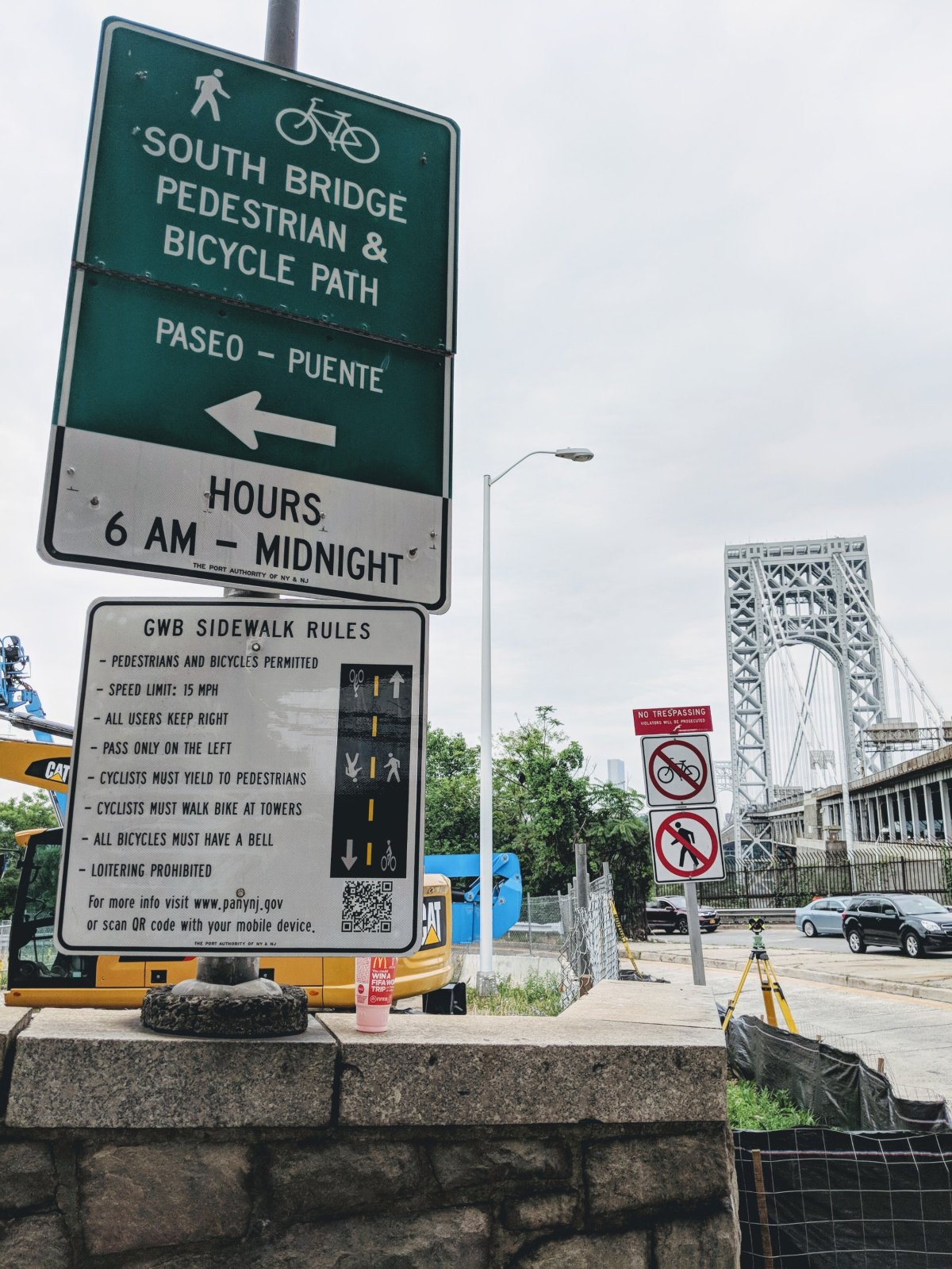
The sign for pedestrian path to the bridge is slightly hidden
We took the A train to 175th street, walked along 178th street to get on the George Washington bridge pedestrian path. There was some construction going on so finding the pedestrian path took some time but we eventually managed.
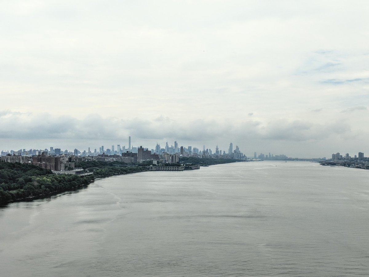
View of Manhattan skyline as we walked along GW bridge
We walked across the bridge which had beautiful views of Manhattan skyline. There are a lot of people biking and jogging across the bridge. Once we crossed the bridge, we went left towards the Fort Lee Historic Park visitor center to get a map.

Walking across GW bridge
We decided to go on the 5.5 mile long Carpenters Loop which starts outside the visitor center. We followed aqua markers to the Historic Park entrance road, then turned right. Soon after that, on the right there are steps going up. The Long trail starts at the top of those stairs.

Hike starts at the top of these stairs
As soon as you get to the top, we suddenly found ourselves in the middle of dense foliage! It’s amazing how quickly the change occurred.

As soon as you go up the stairs, this is what you see!
We continued to follow the aqua markers. The trail is flat and very easy. Along the way, there are a few lookout points with views of GW bridge. Most of these lookout points had benches in case you wanted to spend some time admiring the view or read a book.

The trail had beautiful wildflowers along the way but there’s also poison ivy around this area. We were careful not to touch any plants or to go off the trail.

We continued to follow the aqua markers on the long path towards Dyckman Hill. Most of the hike is along the side of a busy highway but at the same time you are surrounded by lush, green foliage.

This hike is so close to the road that we could see mobile gas station on the side for a bit. By this time we’d been hiking for about two hours and it was lunch time. My stomach was calling out for food.

Once we got to Allison park, we went left on to the road, walked under the bridge and followed Google maps to Mr BBQ, an all you can eat Korean BBQ. Allison park had bathrooms and picnic tables. Every mile or so there are bathrooms along this hike.

This ended up being one of the most decadent and glutenous hikes. The beef bulgogi and spicy pork ribs at Mr BBQ were the best. I couldn’t believe this absolutely delicious and all you can eat Korean BBQ was only $18 per person.

Getting back on the trail after a glutenous lunch
We were very well fed and ready for the hardest part of the hike. We traced our way back to Allison Park road. The hike continues across from the sign that says Saint Peters University.

Just before Palisade Ave
We continued along the long path until we came out of the woods and onto Palisade Ave. On the right there’s a sign for Dyckman Hill Trail.
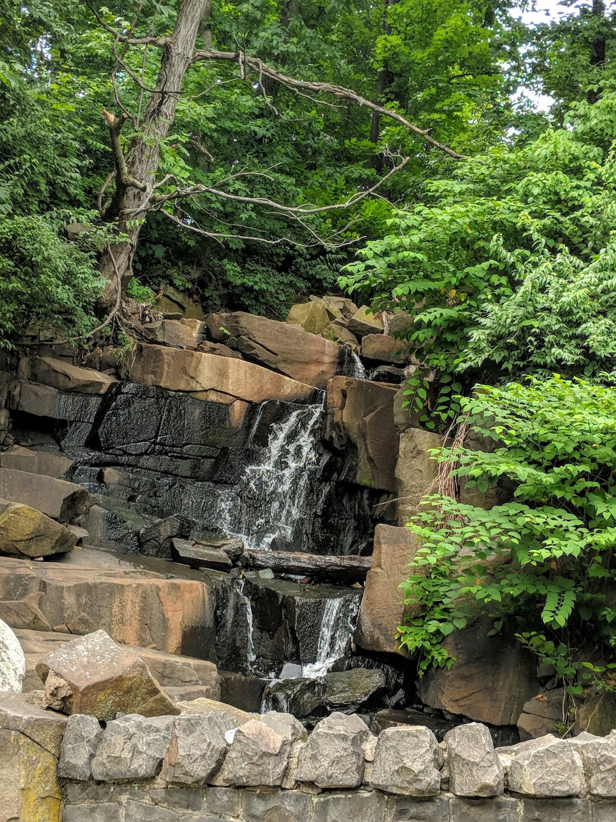
Yellow markers go down the stairs across from this waterfall
We followed the yellow markers for Dyckman Hill Trail. As the road turns, I started to hear a steam. It turned out to be a small waterfall.

Following the yellow markers
Yellow trail goes down a lot of stairs which are just across from the waterfall. About a quarter of the way down we had a beautiful of the waterfall.

After taking about half a dozen pictures with this view, we continued down the stairs. The hike down the trail is beautiful but you need to be careful since the steps are very uneven.

Dyckman Hill trail descends 340 feet in a short time so it’s a bit steep but it wasn’t difficult at all. For me, hiking down a slope is usually easier anyway. At the bottom is Englewood Picnic Area where there’s a small shack.

If we hadn’t stopped for some Korean BBQ, this would have been a nice option. The food probably won’t be better but the view is certainly great.

The scenery suddenly changes again at the bottom. The view up and down the Hudson are very different than the ones from Arden Point hike. This hike is definitely very diverse.

From Englewood Picnic Area we went right and followed Shore trail.The shore trail (white markers) is, as the name suggests, along the shore. We continued on this trail until Ross Dock Picnic Area.

Again, there’s a very nice bathroom with bug spray, sun block, q-tips, lotion, deodorant and much more. This is probably one of the nicest public bathrooms I’ve seen.

We sat at one of the benches for a few mins before continuing with the hike. We continued to follow the white markers for a few more minutes, until we saw a sign for Carpenters Trail across the street.

We followed the blue markers for Carpenters Trail. This is the only part of the hike that is moderately difficult. The trail is steep and involves a lot of steps. It’s definitely doable but I had to take a few short breaks.
Basically we climbed up 340 feet too get back to the top. Once at the top, we were almost back to the starting point. We walked back towards the Fort Lee Historic Park entrance.

We were done with the hike and ready to go back home. Once we were back to the starting point, we took the Jitney bus from Fort Lee George Washington bus stop to get back to Manhattan. By the time we got back home, we had walked/hiked about 9 miles.
Here are some more pictures from the hike.


